Wednesday, May 11, 2016 - 9.84 km https://www.flickr.com/photos/186593395@N08/49460270468/in/dateposted-public/ My original plan for today was to hike from Mt. Elm Campsite to Jarvis Hill Trailhead, then begin the next section of the HT along Yourambulla Ridge before entering Hawker for resupply/rest via the next exit point. That plan was based on the fact that I wanted …
Tag: Backpacking
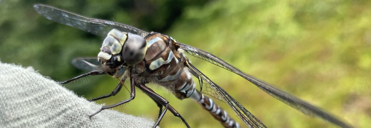
The Heysen 7: Historical Fences
Tuesday, May 10, 2016 - 16.14 km The weather improved overnight and the sky was clear in the morning. Today's hiking was a mix of roadwalking, fence-walking (am I confusing people with this term? Maybe I should say fence-following), and a small amount of cross-country probably following some historical fence. A higher elevation section before …
The Heysen 6: HGTTG
Monday, May 09, 2016 - 19.03 km Today's weather was the same as yesterday's, but the walk was less exposed and didn't present much difficulty other than the mud. A tiny bit of single track (rare!), preceded fence-walking and roadwalking through hilly country. https://www.flickr.com/photos/186593395@N08/49459828903/in/dateposted-public/ https://www.flickr.com/photos/186593395@N08/49460972117/in/dateposted-public/ https://www.flickr.com/photos/186593395@N08/49460739216/in/dateposted-public/ https://www.flickr.com/photos/186593395@N08/49459830893/in/dateposted-public/ https://www.flickr.com/photos/186593395@N08/49459831108/in/dateposted-public/ Calabrinda Creek Campsite was bizarrely located on …
The Heysen 5: Safety Pins
Sunday, May 08, 2016 - 22.05 km I woke up at 10:00 PM, 1:00 AM and 5:00 AM, and rain was pouring down every time. My tent floor soaked through beneath my air mattress, but nothing else got wet. The downpour continued through breakfast and I knew that today's walking would involve exposure in traversing …
The Heysen 4: Mapfail
Saturday, May 07, 2016 - 11.87 km I only hiked 11.87 km today... and it was exhausting. Let me start by explaining something about the HT maps: the HT is represented by a thick blue line transposed over another line showing you whether the route uses 4wd track, road, walking trail or no path at …
The Heysen 3: Flies
Friday, May 06, 2016 - 16.22 km Some excerpts from today's journal notes: 'Terrible flies, shouldn't they land on animal crap somewhere, failure as flies''Flies terrible!!! 100 at once. Piggyback on backpack.''Flies miserable. Almost insufferable but haven't committed suicide.''Flies inside tent - happy to be two centimetres from eyes until made to be two centimetres …
The Heysen 2: Day 1
Thursday, May 05, 2016 - 17.86 km I left the pub around 7:00 this morning, realized after walking several blocks that I still had my room key, and scurried back to slip it under the locked door. I chose to view this incident as 'Discovered mistake so quickly! 🙂 ' rather than 'Blatant incompetence before …
The Heysen 1: Logistics
Wednesday, May 04, 2016 The primary resource for HT hikers is the Friends of the Heysen Trail and Other Walking Trails' website. Currently it's not 100% accurate (for instance, the transport listings need updating and one of the links leads to someone's unrelated blog) but it contains useful information about trail towns, campsites and the …
The Heysen Trail: Introduction
Located in the lovely land of South Australia, the Heysen Trail extends for 1200 kilometres (more or less) from Cape Jervis to Parachilna Gorge Road. Scenery includes the Flinders Ranges, the hilly country around Adelaide and a chunk of coastline, with the route crossing both public and private land. The trail itself contains some single …
The Arizona Trail: Final Thoughts
Tuesday, June 11, 2013 So there you have it - my recount of how I came, saw and managed to survive the Arizona Trail. It was an experience made incredible both by its nature and how wildly different it was from anything I've done before, and I still feel like I'm stuck in a limbo …
The Arizona Trail Day 77: Civilization Is in the Other Direction
Sunday, June 02, 2013 The cicadas were noisy in the morning. I collected a few exoskeletons for my niece and started off. The temperature increased rapidly. I had plenty of water but was rationing it because I didn't know how long I would have to wait for Pops C at Stateline Campground. At the Buckskin …
Continue reading The Arizona Trail Day 77: Civilization Is in the Other Direction
The Arizona Trail Day 76: Emergence
Saturday, June 01, 2013 Jacob Lake Inn has a reputation for making great cookies, so I bought some before I left today. They were underbaked. NOOOOOOOOOOOOOOOOoooooooo! I was so disappointed (I still ate them all). I'm giving the 'best cookies along the AZT' title to Summerhaven, since Summerhaven and Pine both had great-tasting cookies, but …
The Arizona Trail Day 75: Turkeysquirrel
Friday, May 31, 2013 Because of my long day yesterday, today I had a short jaunt to Jacob Lake, which can be accessed either via forest roads or a highway walk. I decided on the highway walk since its junction is 3-4 km further along the AZT and I wanted to complete those kilometres with …
The Arizona Trail Day 74: Screaming Children
Thursday, May 30, 2013 The AZT was entirely in forest today. At Telephone Hill, a short, steep climb ended in a major burn area with shrubbery and dandelions scattered around trees like black sticks. The wind sounded like children screaming. Freak me out, will you? I sat down, ate loads of chocolate and then automatoned …
Continue reading The Arizona Trail Day 74: Screaming Children
The Arizona Trail Day 73: The Falling Piano
Wednesday, May 29, 2013 I woke up today, ate granola, looked at my GPS to record my location for journaling purposes, looked at the databook. Looked back at the GPS. Looked back at the databook. Oops. I wasn't out of Grand Canyon National Park. Due to the rain and well-built trail I hadn't been checking …
Continue reading The Arizona Trail Day 73: The Falling Piano
The Arizona Trail Day 72: Backpacker Ken Doll
Tuesday, May 28, 2013 - 19.6 km Pops C suggested that we walk the last few days of the AZT together and hitchhike out to Lake Powell, where one of his in-laws could drive us to Flagstaff. The AZT ends at the Stateline Campground in the middle of nowhere and I had no plan about …
Continue reading The Arizona Trail Day 72: Backpacker Ken Doll
The Arizona Trail Day 71: I Could Leave Today or I Could Never Leave
Monday, May 27, 2013 When I went to the lodge this morning for breakfast, a family invited me to eat with them. Some of their relatives were attempting a rim-to-rim across the canyon, hiking the entire distance in one push. Previously I had thought that was something people did if they couldn't get a permit …
Continue reading The Arizona Trail Day 71: I Could Leave Today or I Could Never Leave
The Arizona Trail Day 70: Leaving the Canyon
Sunday, May 26, 2013 - 10.8 km https://www.flickr.com/photos/186593395@N08/49446131433/in/dateposted-public/ I started walking at 6:00 AM today. The trail was moderate leaving Cottonwood, and considering that I would have to gain 1268 metres of elevation within eleven kilometres, I kept wondering when the grade would steepen. The grind turned out to be at the very end, and …
Continue reading The Arizona Trail Day 70: Leaving the Canyon
The Arizona Trail Day 69: Inside the Canyon
Saturday, May 25, 2013 - 12.4 km Pops C laughed when I told him yesterday that I been assigned the stock site at Cottonwood Campground. Well, I'll have you know that I arrived to find no droppings anywhere, just a group of good-looking men working to improve the site. I kid you not. I bet …
Continue reading The Arizona Trail Day 69: Inside the Canyon
The Arizona Trail Day 68: Incredibly Naughty
Friday, May 24, 2013 - 11.3 km I was only minutes from leaving the campground this morning when Pops C arrived. He told me that he was planning to hike rim-to-rim without getting a permit, starting tomorrow and arriving the day afterwards, and offered to buy me dinner on the North Rim. Sounds good to …
Continue reading The Arizona Trail Day 68: Incredibly Naughty
