Saturday, July 21, 2018 – 15.20 miles
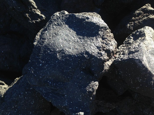
Another day of fantastic hiking. I walked on lava!

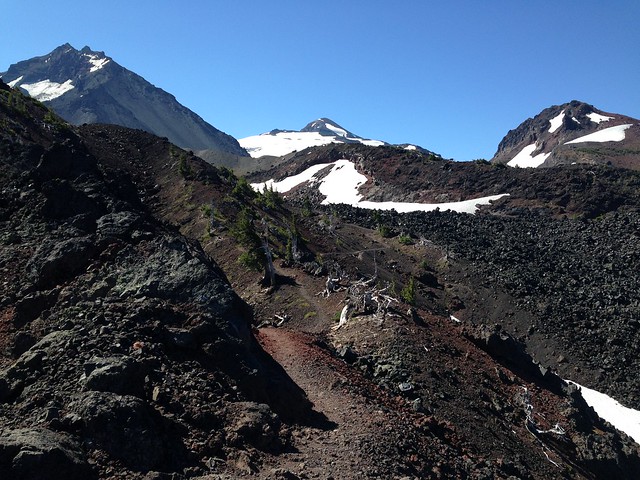
Approaching Collier Cone, I noticed a side trail to a ‘Collier Glacier View’ on the map. It was steep but short, and I was treated to the most amazing view of a barren basin rimmed by North Sister, Middle Sister and Little Brother.

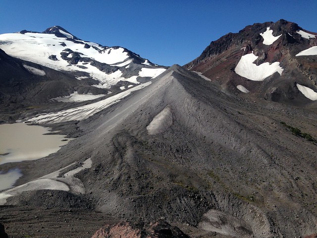
In the other direction were views of Mt. Washington, Three-Fingered Jack, Mt. Jefferson and Mt. Hood.

I loaded up with 25 miles’ worth of water at Minnie Scott Spring, enough to get me to Santiam Pass, where I’ll hitchhike into Bend. There are lakes on the way, but I’m not carrying much food weight now, so carrying a few extra litres to avoid lake water is no problem.

Following pretty South Matthieu Lake and a patch of forest was a difficult area of lava rock before Highway 242. The foot/ankle that I injured pre-hike feels normal 99% of the time, but hurts badly for a few minutes if it tilts too much, so I walked slowly. More lava rock followed the highway, the entire expanse being an incredible sight.


4.3 miles from the highway, I met a group of two older and two younger men. I had said hi and was passing by when one of them asked me for water. He explained that they had run out of water about five miles from Big Lake (Big Lake is 11-12 miles from the highway) and decided to return to their car. I gave them water of course, but I wasn’t pleased. Their excuse was that they had misjudged how much water ‘big grown men’ need, apparently having researched for their trip in a Girl Scout manual, but what matters is acknowledging that you’re low on water and making the decision to turn around at a prudent time. I’m weak against grovelling though, so inevitably softened and said some things about how it was ‘hard country’. It was hard country, to be fair, and not the type of terrain that you want to be crossing at night when temperatures have cooled.
Speaking of walking on lava rock at night. I started getting antsy with the sinking sun illuminating no potential campsites, but reached an established campsite on a dirt patch before dark. I don’t have a good reference point for this campsite, so the distance walked is a guess.

