Saturday, May 25, 2019 – 15.90
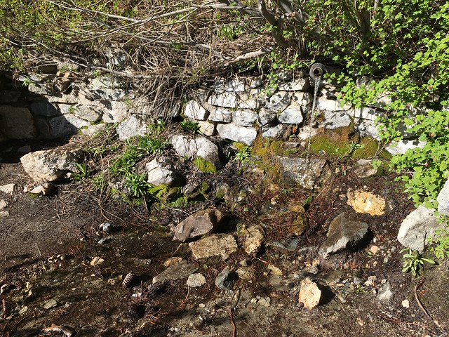
I was sluggish in the morning and didn’t start walking until 7:30 AM. Little Jimmy Spring was closer than I had thought – the data points in eTrails are funny here – and flowing strong below the trail.
15-20 tents were still pitched in the campground when I arrived. My sluggish peers! The campground was nice enough, but both of the locks were broken on the outhouse I went into. I can’t perform under these conditions…

On my way to Islip Saddle, a group of hikers told me that someone fell off the ridge yesterday and was getting evacuated today. I saw the helicopter as I started down the South Fork Trail. Is witnessing two helicopter rescues during one hike above average? IT SHOULD BE.
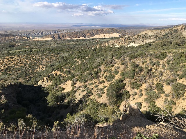
The South Fork Trail starts behind the picnic benches at Islip Saddle. The PCT passes above and two hikers shouted down to me ‘the PCT is up here!’. Ah, the SFT detour is so unpopular that people don’t even know where it begins… The first section of the trail was in good condition, a pleasant stroll through the forest. After ten or fifteen minutes, I met two day hikers who gave me a detailed description of trail conditions ahead, also mentioning that they were walking the trail in both directions. I concluded that okay, this trail can be hiked and won’t inflict trauma. Necessarily.
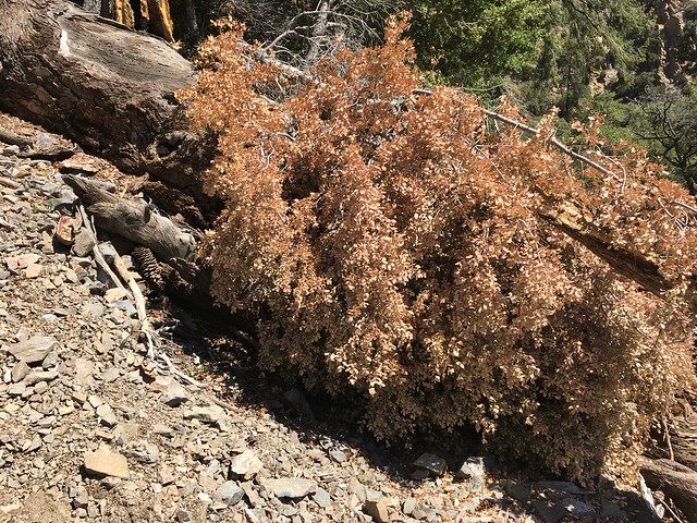
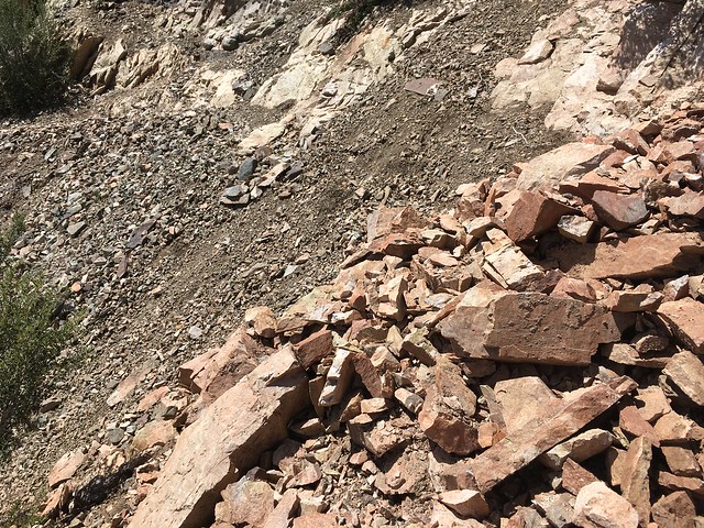
Here’s a photo of one of the first sketchy bits I encountered, and a good representation of the average degree of sketchiness on the SFT:

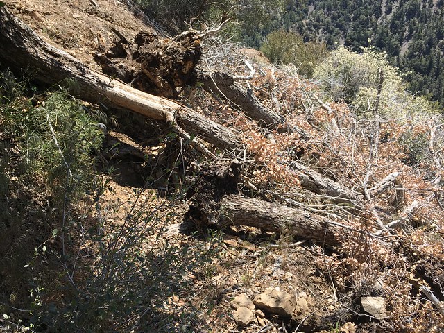
There were three deadfall obstacles. Here’s the first. I climbed above, but looking at the obstacle from the other side, it may have been easier to go below.
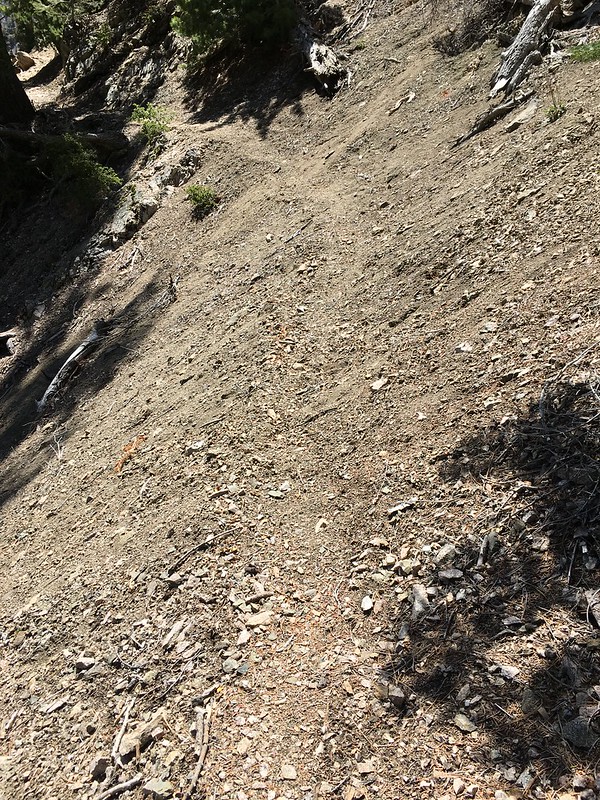
Soft and narrow trail after the first obstacle:
Deadfall obstacle 2/3 was easy to slip beneath:

Between the second and third obstacles, I encountered the first place where the trail was essentially gone.
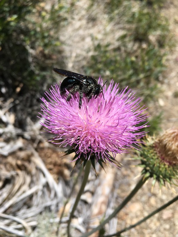
Getting scared? Here are some random flower photos:

Here’s the third obstacle. I tried to climb over. Don’t try to climb over! I was swarmed by tiny biting ants. I ended up climbing the slope above the trail.
After the third obstacle I hit another place where the trail had basically eroded away:

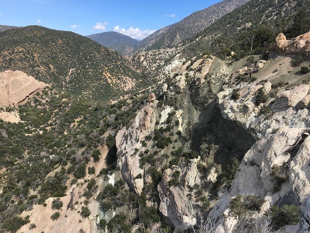
The walk through the upper canyon was pleasant, but the lower canyon was gorgeous, with high rugged cliffs.


More scary trail. The second picture sort of looks like a nightmare, but it’s actually the trail.


The couple that I had met earlier passed me near the bottom of the canyon, still in good spirits. My nerves were frayed and I was glad to step onto the friendly canyon floor. Unfortunately there was graffiti on the rocks around the creek, the ne’er-do-wells of this region apparently having gotten bored with vandalizing Deep Creek.
Today is Saturday, and South Fork Campground was crammed with car campers. Its location is nice, but there was broken glass and such around. I saw people standing in the creek with an inflatable boat. The creek… it’s not big enough…

Like I mentioned in my last entry, the PCTA describes the trail from Islip Saddle to South Fork Campground as the part of the detour in worst condition, so I was hoping that things would improve once I forded the creek and started along the High Desert National Recreation Trail. I did so, finding a deer tick on my ankle during my next break. Gross! Continuing along, I found three men with beer cans sliding on their butts down an eroding slope between two switchbacks. That’s possibly the worst behaviour I’ve ever witnessed on a trail, but I didn’t want to confront them myself. If I’d had some young PCT bucks with me I would have complained, then made my escape while the young PCT bucks were getting beat up.
Overall, the trail between South Fork Campground and the Devil’s Punchbowl was in much better condition than the SFT. Holcomb Canyon Creek had lovely established campsites, a good alternative to South Fork Campground (don’t camp between the Devil’s Punchbowl and Devil’s Punchbowl County Park, the trail is filled with tourists). I would have liked to camp at the creek, but the weather is supposed to be bad tomorrow – yes, again – so I wanted to see as much as possible today.

The Devil’s Punchbowl was highly impressive. I would recommend visiting the Devil’s Chair, because it’s there. To continue along the detour, take the unmarked trail at the junction.

Finally PCT signage, at the Devil’s Punchbowl County Park junction.

Past the junction, I met two older day hikers. The man exclaimed ‘Oh, a PCT hiker actually hiking the PCT!’ and at first I thought that he was referring to this being the ‘official’ detour, but it turned out that he thought the normal PCT route uses the Manzanita and High Desert National Recreation Trails from Vincent Gap to Burkhart Junction and doesn’t go over Mt. Baden-Powell at all. You would think that he would believe someone currently hiking the PCT about where it goes, but when I corrected him, he refused to believe that he was incorrect. Okay, whatever.
I camped less than a mile before Cruthers Creek. I’m so happy to have had a day of gorgeous weather!
